If a picture is worth a thousand words, then the article is predominately a lie. Is that the distribution you'd expect of contaminated ocean water? For reference, here are the currents in the Pacific.

In comparison, in their map the radiation seems to be moving linearly from the source. What in the ocean moves linearly from the source? Maybe waves? And indeed a 2-second Google search for "noaa fukushima tsunami map" reveals the answer.
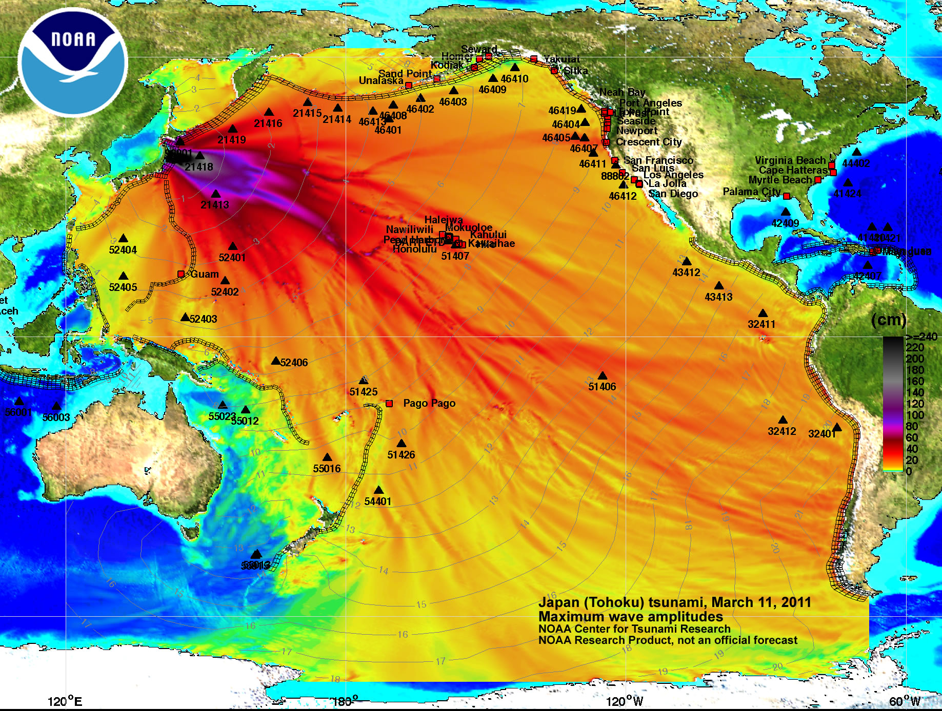
Despite attributing the source to NOAA based on the image logo, ZeroHedge clearly didn't confirm the validity of the source, or they'd see the image had been altered by cropping off the text that explains what the image is. Amusingly enough, the mastermind who concocted the ruse left in the scale which shows the data is measured in centimeters, a very odd unit for radiation, wouldn't you think?
No comments:
Post a Comment